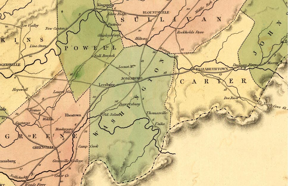
One of the benefits of being a railroad center
is that Johnson City, Tennessee was superbly mapped in its early years.
Many railroad maps as well as other sources have been digitized
by the Library of Congress.
Perhaps the best source for tracking the development patterns of American
cities are historic fire insurance/ratings maps. These maps were updated
on consistent intervals and provided incredible detail on construction
activities and property uses. Attached below are selected fire insurance
maps from 1891 through 1927 for Downtown Johnson City (Adobe .pdf files)
and assorted other city, county, railroad, regional maps and aerial photos that provide
value for local historians and genealogists.
| Railroad
and Johnson City Area Maps & Aerial Photos |
|
Topic |
Maps |
| Plat of Carnegie, Tennessee | |
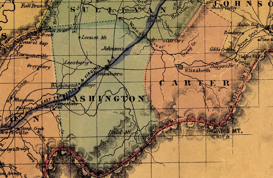
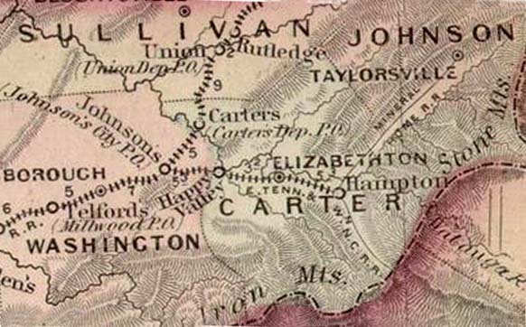
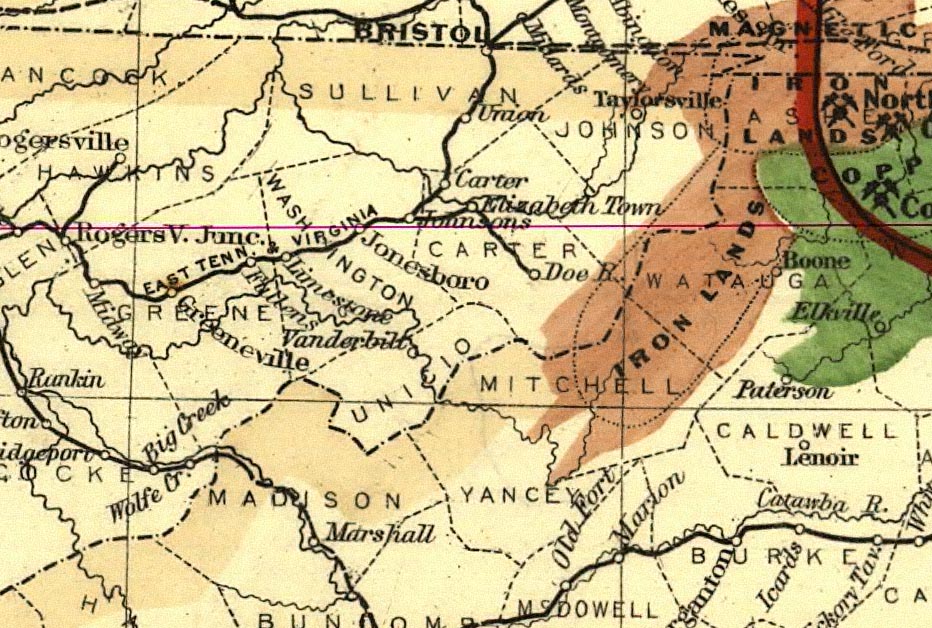
| Railroad Map | |
| Downtown Johnson City Fire Maps | |
| Downtown Johnson City Fire Maps | |
| Downtown Johnson City Fire Maps | |
| Downtown Johnson City Fire Maps | |
| Downtown Johnson City Fire Maps | |
| Downtown Johnson City Fire Maps | |
| Downtown Johnson City Fire Maps | |
| General Plan Map by
John Nolen Nolen's Plan for Kingsport |
|
| County Atlas | |
| State Map | |
| State Map | |
| Panoramic Photo | |
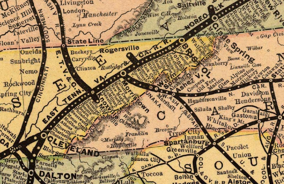
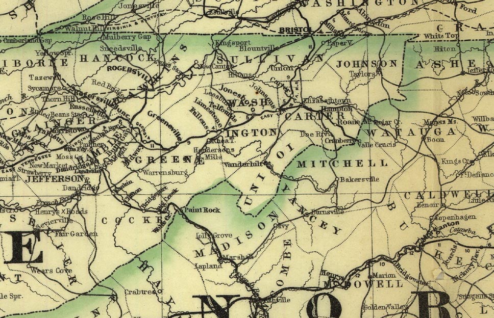
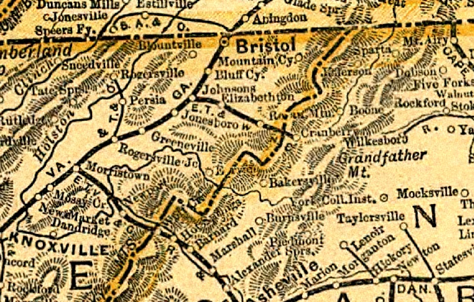
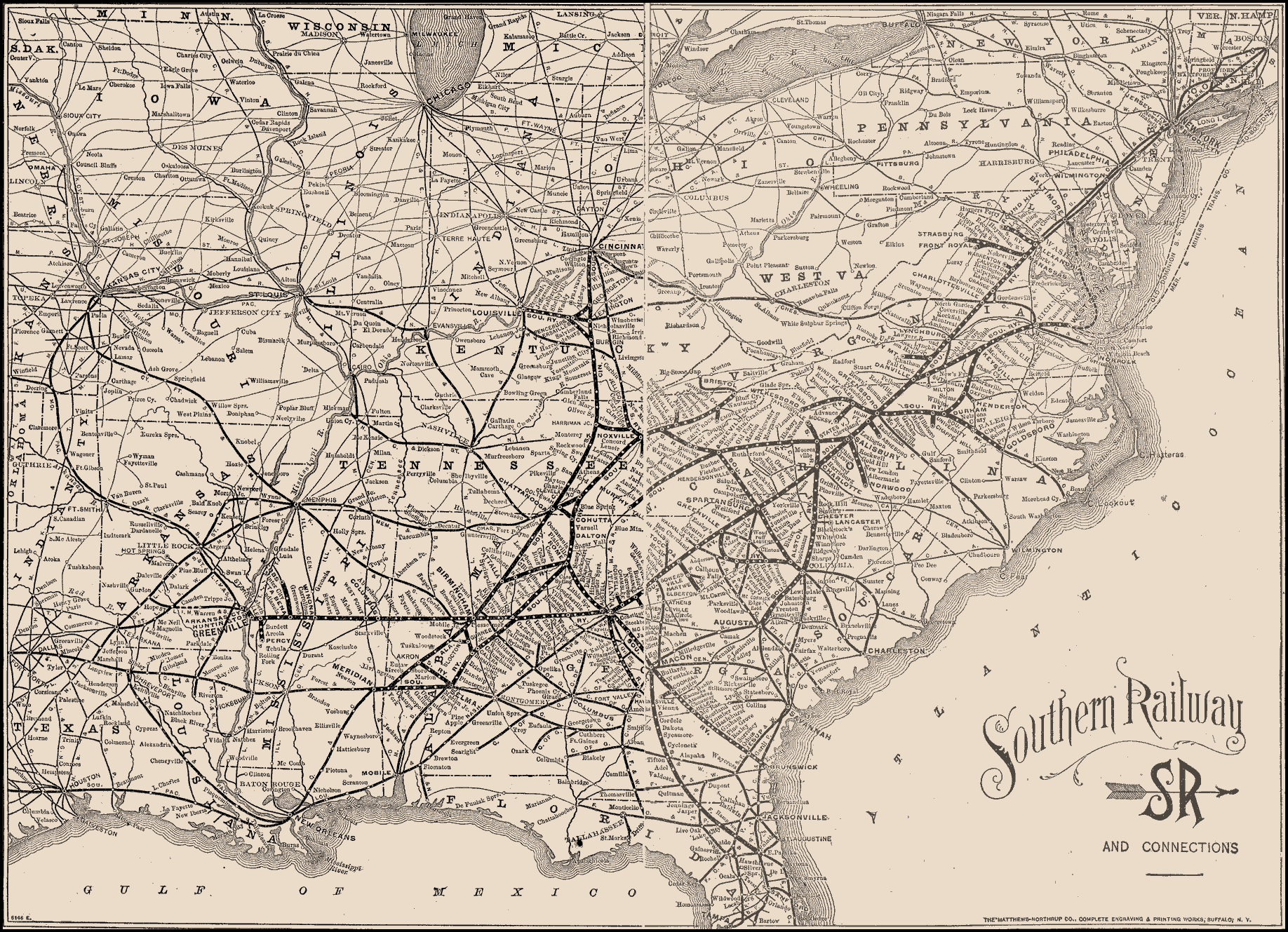
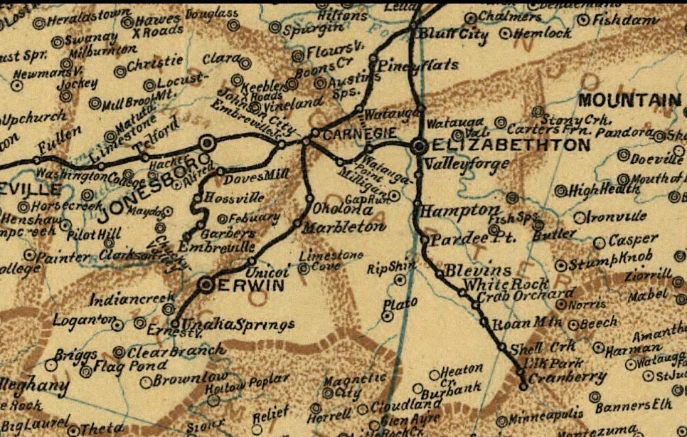
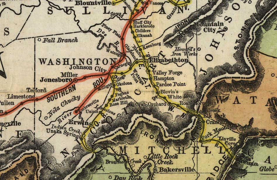
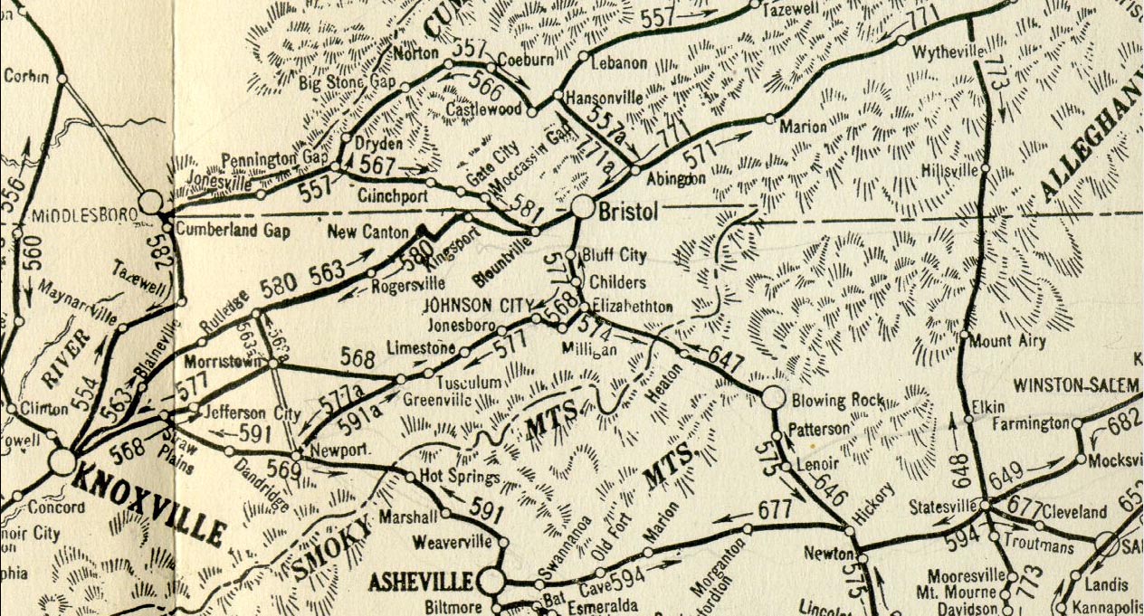
| Railroad Maps | Library of Congress: American
Memory Collection |
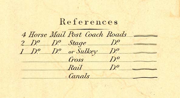
| Stagecoach Map | |
| Railroad Map | |
| Railroad Map | |
| Railroad Map | |
| Railroad Map | |
| Railroad Map | |
| Railroad Map | |
| Railroad Map | |
| Railroad Map | |
| Railroad Map | |
| Railroad Map | |
| Railroad Map | |
| Railroad Map | |
| Railroad Map | |
| Railroad Maps | |
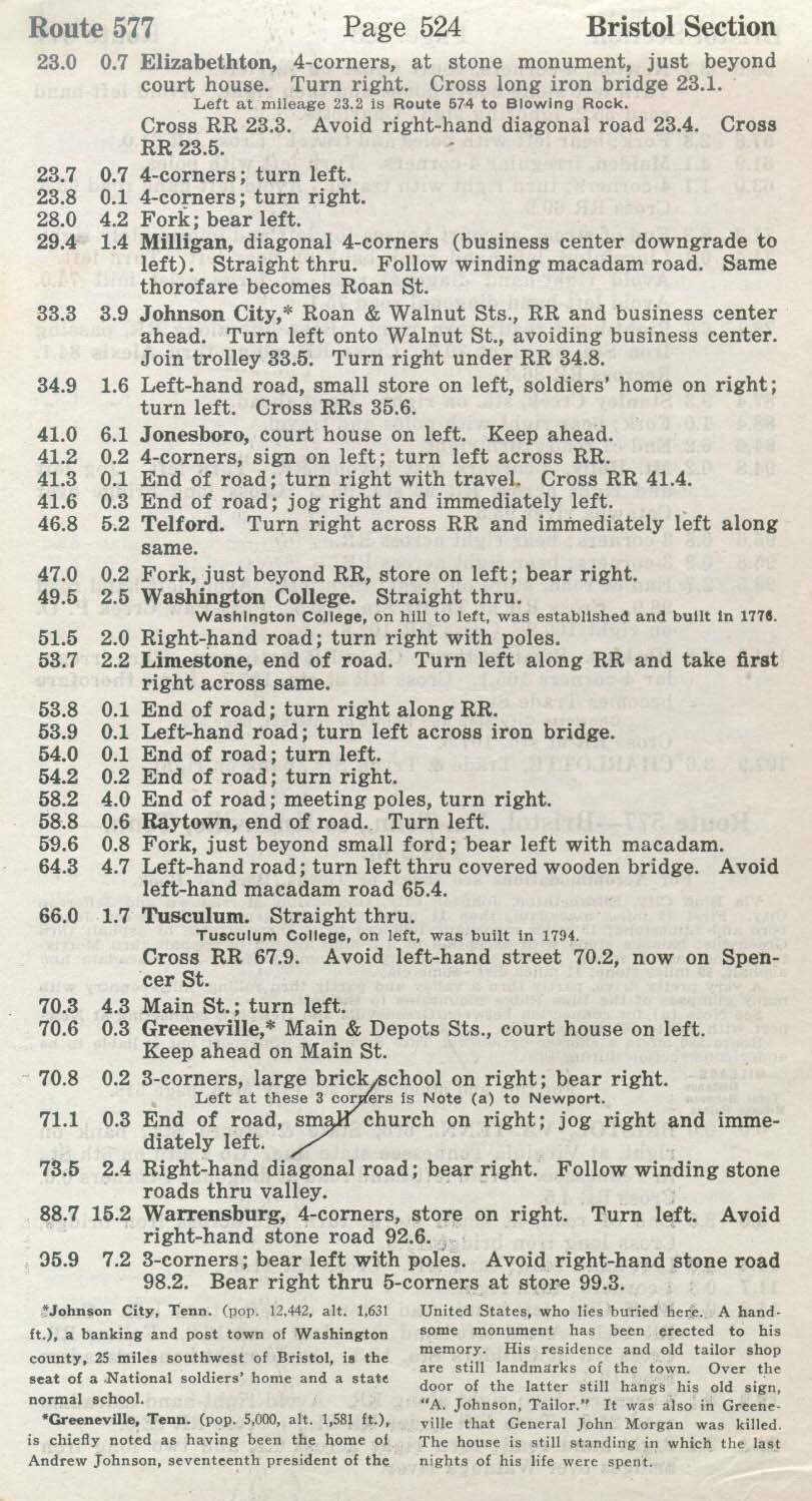
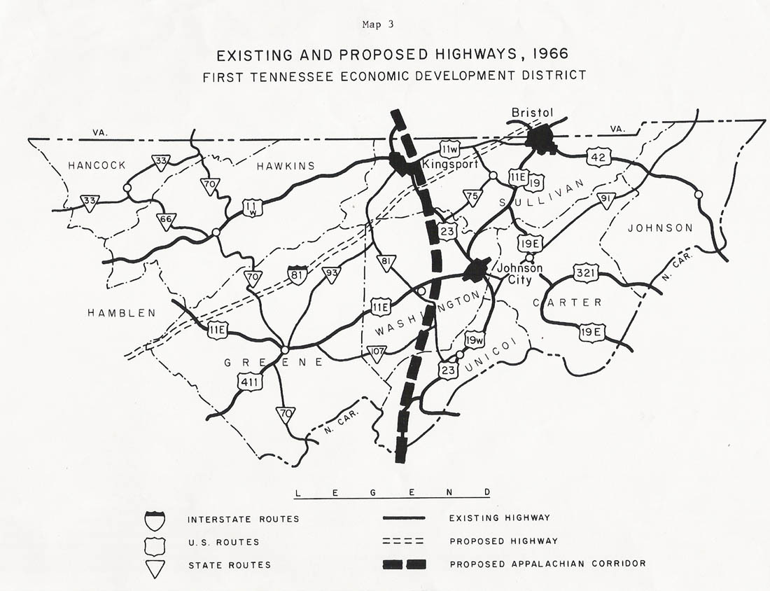
| Highway Map | |
| Directions | |
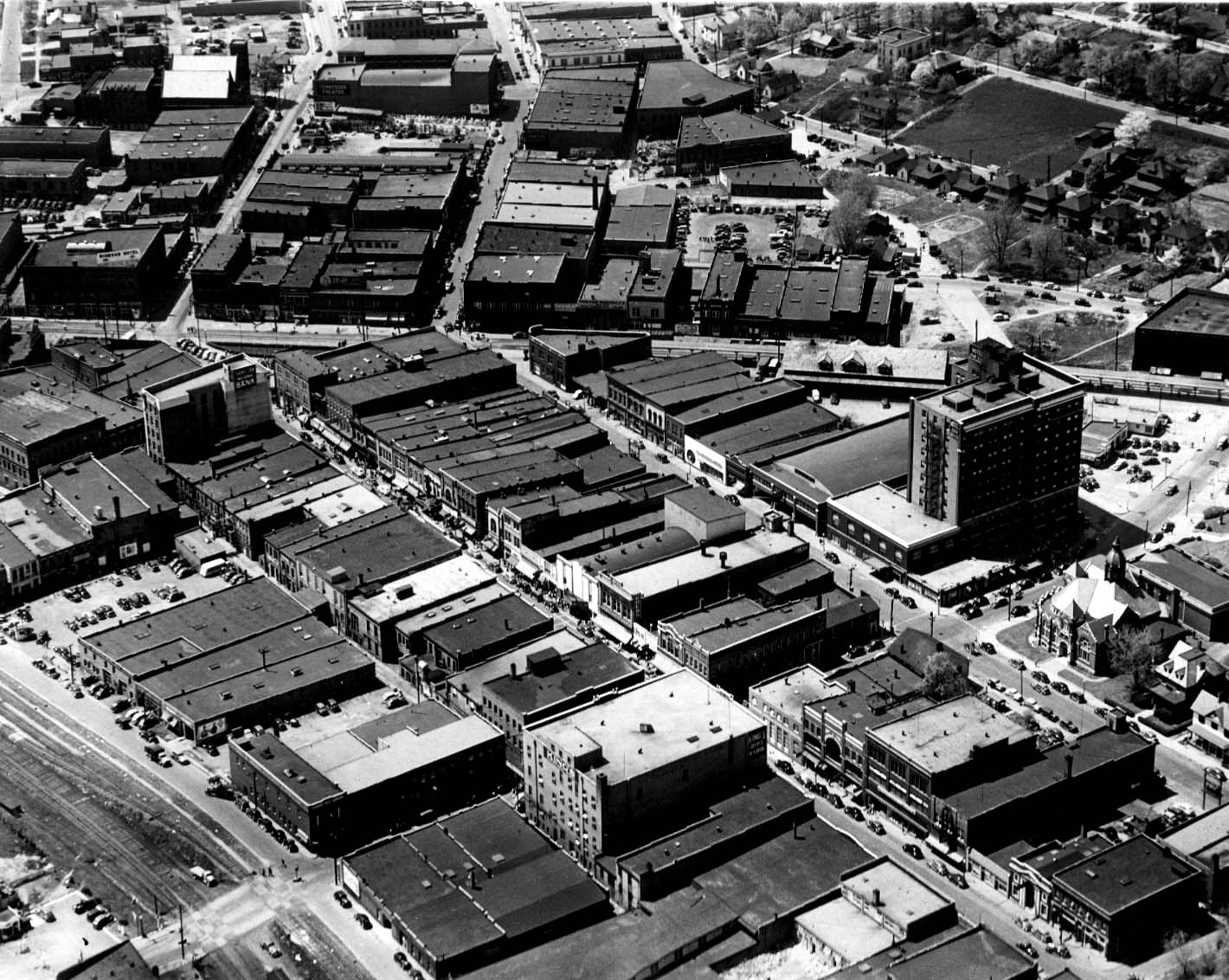
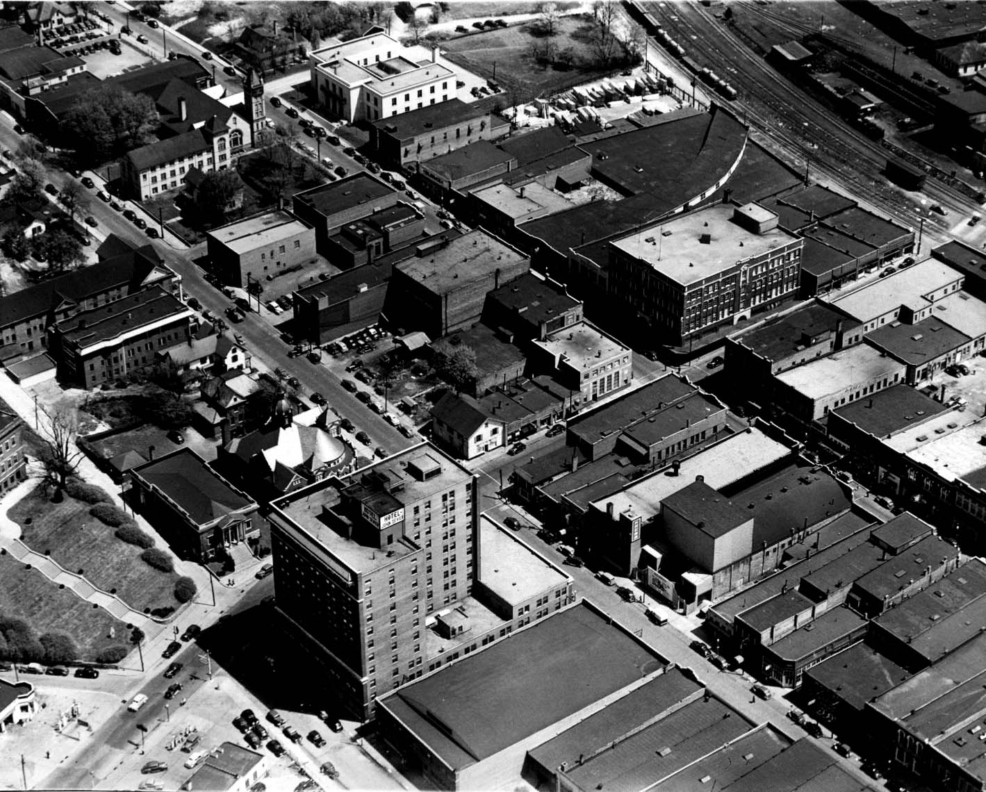
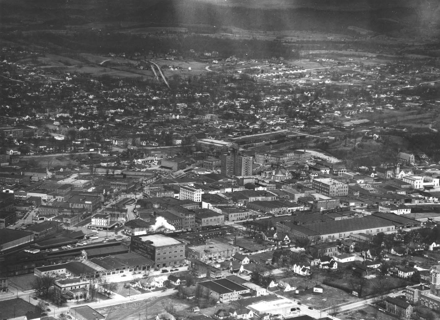
| Aerial Photos | |
| Aerial Photos | |
| Aerial Photos | |
| Aerial Photos | |
| Aerial Photos | |
| Highway Map | |
| Historical Collections | |
| Mapquest Street Map | |
| Historic
Population Data |
||
| Census |
Washington County |
Johnson City |
| 1870 |
16,317 |
500 |
| 1880 |
16,181 |
685 |
| 1890 |
20,354 |
4,161 |
| 1900 |
22,604 |
4,645 |
| 1910 |
28,968 |
8,501 |
| 1920 |
34,052 |
12,441 |
| 1930 |
45,805 |
25,080 |
| 1940 |
51,631 |
25,322 |
| 1950 |
59,971 |
27,864 |
| 1960 |
64,832 |
31,187 |
| 1970 |
73,924 |
33,770 |
| 1980 |
88,755 |
39,753 |
| 1990 |
92,315 |
50,354 |
| 2000 |
107,198 |
56,767 |
2010 |
122,979 |
63,152 |
 |
|||
 |
|||
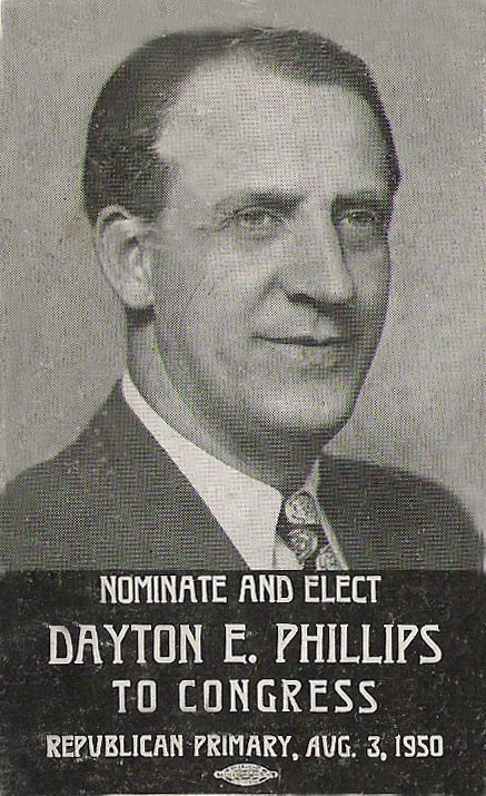 |
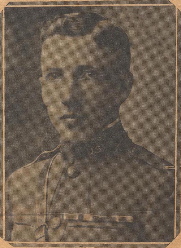 Congressman and World War I Hero |
||
|
|||||||||||||||||||||||||||||||
 |
|||||||||||||||||||||||||||||||
 |
 |
||||||||||||||||||||||||||||||
|
|||||||||||||||||||||||||||||||


